Satellite Globe
A live map of low earth orbit.

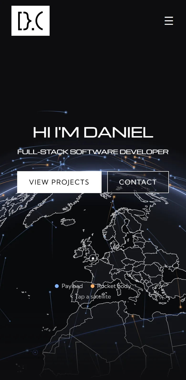
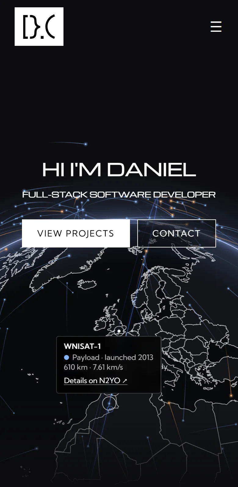
The globe at the top of this site's home page is a live map of low earth orbit. Each dot is a real tracked object, drawn where it is right now, in a view framed on the south of England. Hover over one to see its name, altitude and speed, or click or tap to pin it and follow it across the sky.
I wanted a hero that was accurate rather than decorative. It runs in real time, so nothing moves faster than it does in orbit, and the altitude and speed should agree with a satellite tracker to within a few kilometres.
It is built with React and TypeScript on Next.js, and drawn on a plain 2D canvas with no WebGL or mapping library. satellite.js does the orbit propagation, the orbital elements come from CelesTrak, and the coastlines are Natural Earth data that I simplify and encode with a build script.
- Stack
- Next.js · React · TypeScript · Canvas 2D · satellite.js
- Data source
- CelesTrak (opens in a new tab)
- Map data
- Natural Earth 50m
- Status
- Live on the home page
Highlights

Pin a satellite
Hovering a dot shows its name, type, launch year, altitude and speed. Clicking pins the tooltip so it follows the satellite and adds a link to its page on N2YO.

Orbit track and ground point
One satellite at a time gets its path for the 48 minutes either side of now, drawn faintly where it passes behind the earth; hovering or pinning chooses which. A dashed line drops to the point on the surface directly beneath it.

Keyboard access
The canvas takes focus like any other control. The left and right arrow keys step through the satellites in view from one side of the sky to the other, raising the same tooltip and link as a click, and Escape lets go.
How It's Built
The positions are computed in the browser. The server sends a two-line element set for each object, satellite.js propagates it with SGP4, and I rotate the result into an earth-fixed frame and project it orthographically from a camera fixed over one point on the ground. Mistakes in this kind of maths are hard to spot by eye, so a small script runs some sanity checks: an ISS element set has to come out at roughly 415 km and 7.66 km/s, the camera basis has to be orthonormal, and a point 90 degrees from the centre of the view has to land on the limb.
On a full page load the map is painted as the HTML parses, without waiting for the JavaScript bundle or for React to hydrate. The function that paints the disc, land and coastlines is written with no imports, so the server can turn it into a string and inline it in a script tag. The component later uses the same function for its offscreen layer, so the two paints match. The coastline data is a separate content-hashed file, so it is downloaded once and cached.
The browser never asks for satellite data. The element sets are fetched on the server from six small CelesTrak groups and cached for two hours, so the page is regenerated at most a few times a day and served from cache in between. Each fetch has a six-second deadline, and a group that fails falls back to a snapshot committed to the repo, so there is always something to draw.
Tracking a few hundred objects and drawing the visible ones every frame took some care. Positions are recomputed in slices, a twelfth of the catalogue per frame, and the glow on each dot is a pre-rendered sprite rather than a shadow blur. The loop stops when the hero scrolls out of view or the tab is hidden, and after anything more than a brief pause it catches everything up in one pass. With reduced motion set it draws single frames on demand and still answers the pointer.
On Mobile
On a phone the dots are drawn smaller and the touch target around each one is larger, so a single satellite can still be picked out.